DMLW Managed Land and Water
DMLW is responsible for managing general state lands, including about 100 million acres of uplands, plus 65 million acres of tidelands, shorelands and submerged lands covering about 34,000 miles of coastline.
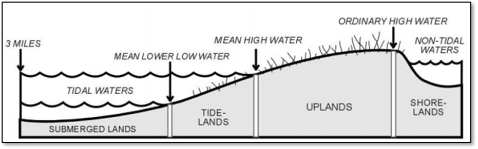
The State of Alaska owns most of the tide and submerged lands along its coastline, granted to the State under the Submerged Lands Act of 1953. Tide and submerged lands include all land between the mean high tide line and three miles offshore of the mean low tideline. There are a few exclusions to the State's ownership of these tide and submerged lands, such as those lands conveyed to municipalities or those withdrawn before statehood. The State also owns shorelands, which are lands covered by navigable, nontidal water up to the ordinary high-water mark as modified by accretion, erosion or reliction. See Figure 1 for a depiction of these lands.
To research ownership of specific lands see DNR's research tools, including Alaska Mapper. Please contact SAIL or the Public Information Center with questions about ownership of specific lands.
During a spill response, one of SAIL's roles is to verify land ownership and identify third-party interests — that is, people or entities to whom DMLW issued an authorization. Alaska Mapper and the Alaska land records systems are good places to look for ownership and third-party interest information.
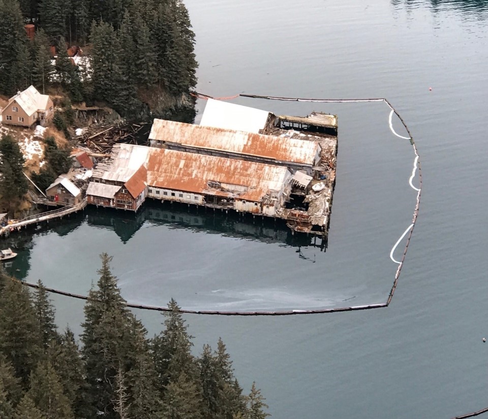
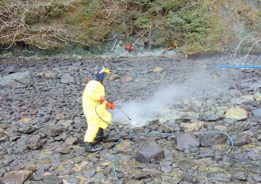
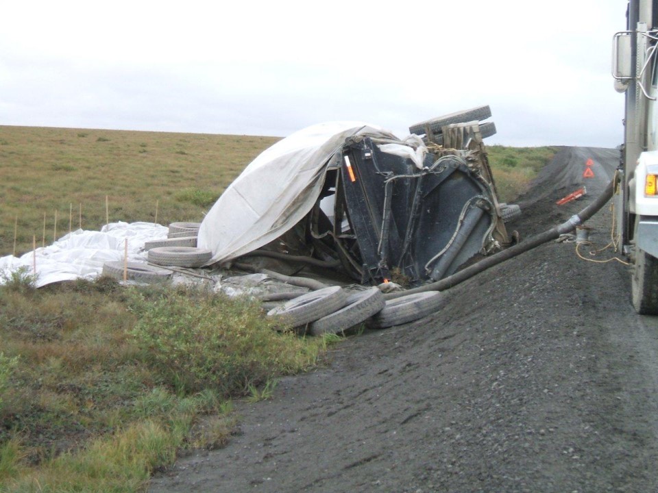
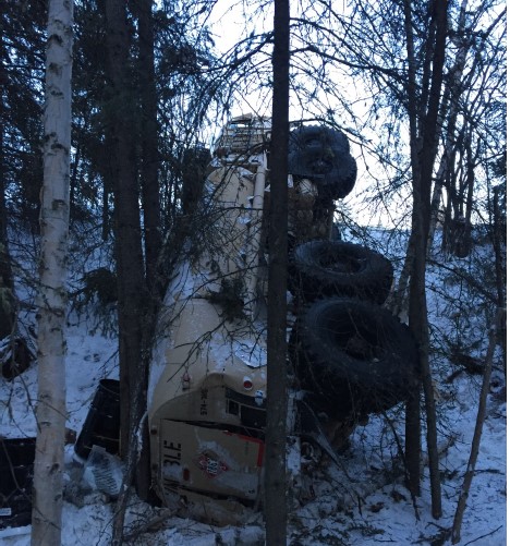
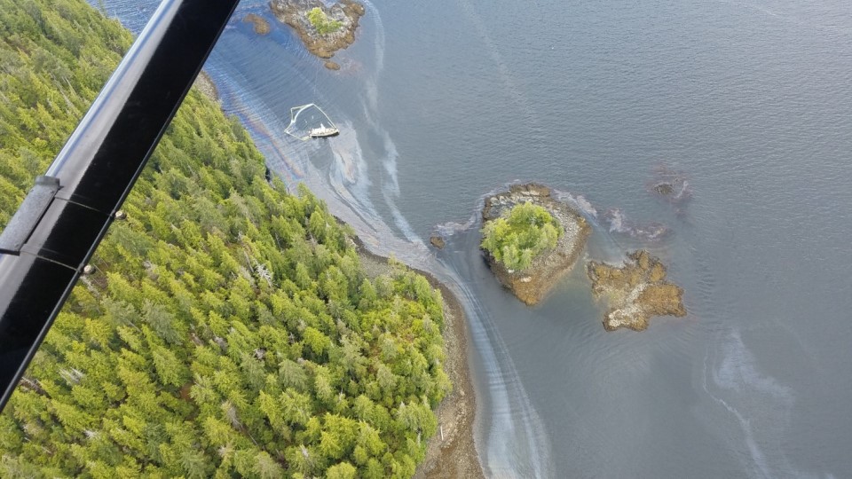
The following graphic and photos illustrate impacts to DMLW-managed land from spills and ADVs.